September 5, 2014 — The U.S. Air Force has a new tool in its effort to preserve space history: lasers.
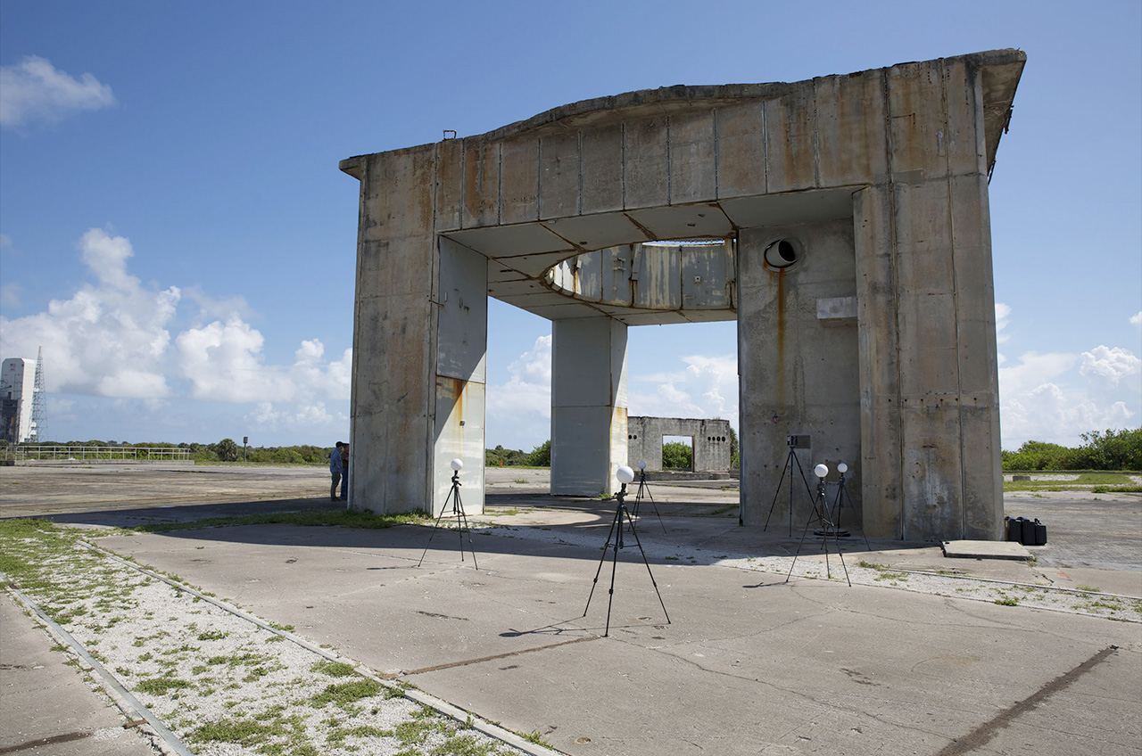
The 45th Space Wing at Patrick Air Force Base in Florida has partnered with the University of South Florida Alliance for Integrated Spatial Technologies (AIST) to use a laser scanner to survey, map and create virtual models of some of the historic space launch complexes at Cape Canaveral Air Force Station (CCAFS).
"Some of these [launch] complexes are in poor shape," Tom Penders, the cultural resources manager for the 45th Space Wing, said in an Air Force interview. "A couple [of the structures] are on the verge of collapsing, so I wanted highly detailed documentation before something happens."
Cape Canaveral Air Force Station was the site from where NASA's early manned flights launched. Alan Shepard, the United States' first astronaut in space, lifted off from Cape Canaveral's Complex 5, and John Glenn became the first American in Earth orbit after launching from Complex 14. The two-man Gemini missions flew from Complex 19 and the first manned Apollo command module departed off of Complex 34.
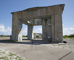
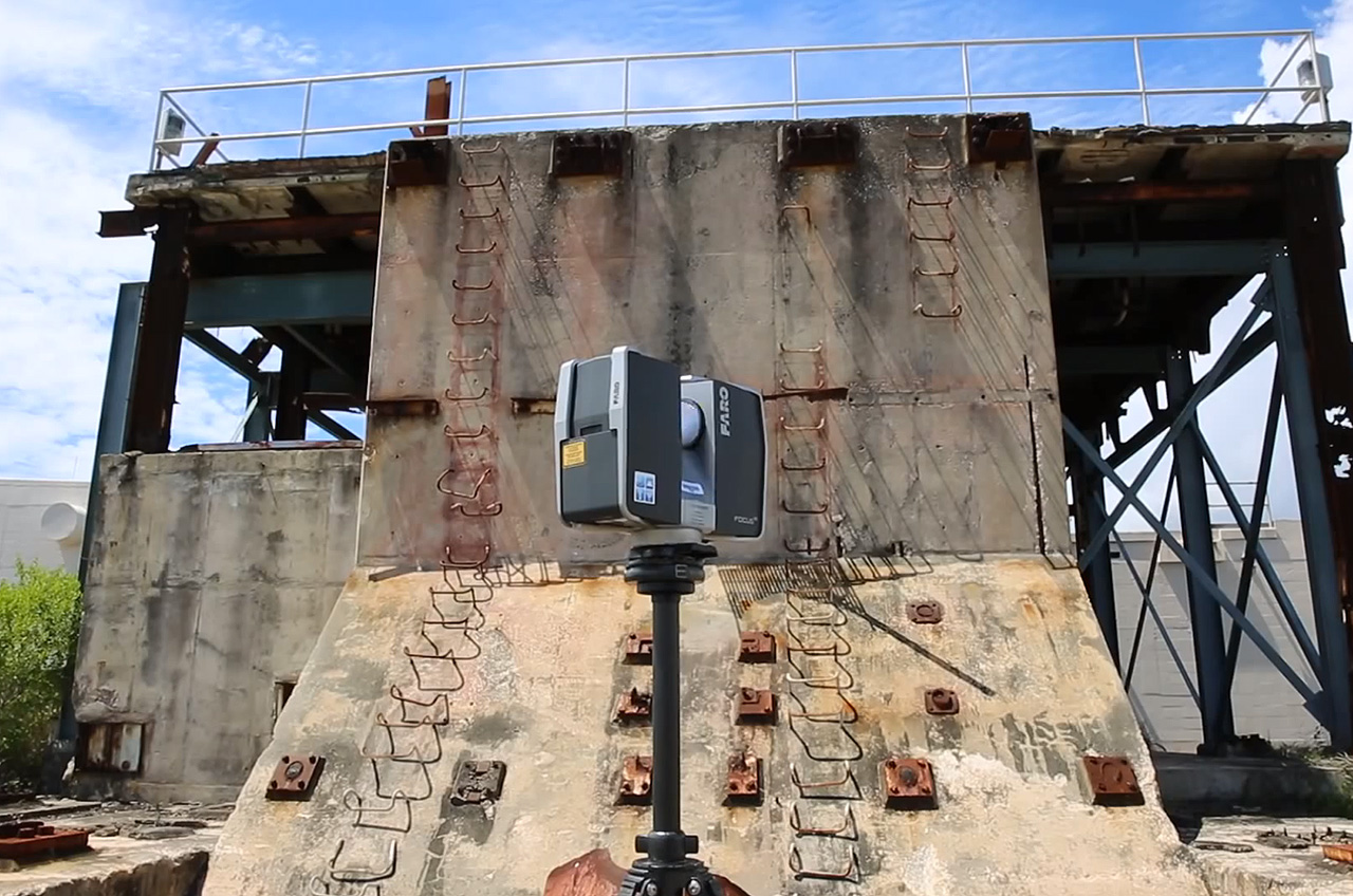
A tripod-based laser scanner and reference points are positioned at the Cape Canaveral Air Force Station's Complex 34 to capture 3-D images of the Apollo-era launch pad. (USAF/Eddie Green) |
The station's proximity to the Atlantic Ocean has exposed the historic launch pads to a highly corrosive environment over the past five decades. The Air Force, challenged by limited funding for major preservation projects, has turned to cutting-edge technology to document and preserve the gantries and support buildings before they are lost to the degrading effects of the salty winds.
"We consider many of these structures to be endangered species, meaning that they are unique and sometimes the last of their kind," Lori Collins, the co-director of the AIST program at University of South Florida (USF), said. "We're looking at ways to preserve them digitally and holistically, as well as improve chances for effective stabilization and maintenance."
The scanners use lasers to create high-speed, 360-degree scans, and are able to measure approximately one million data points per second of everything within 360 yards (330 m). The 3-D images are so accurate that millimeter-sized details are able to be examined and analyzed.
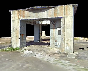
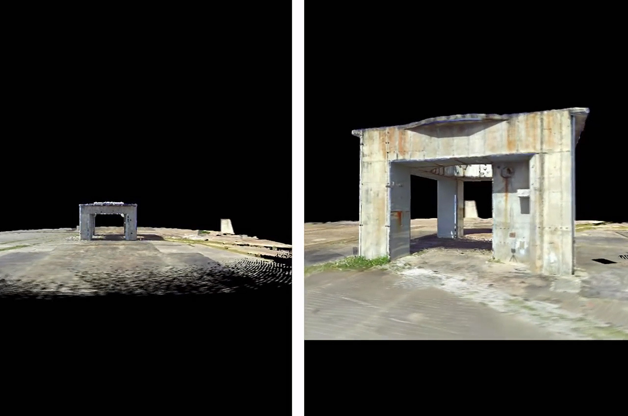
Virtual model of the launch pedestal at Cape Canaveral Air Force Station's Complex 34 based on the data from laser scans. (USAF) |
"[It] provides an accurate, detailed record of the historic properties," Heidi Mowery, the cultural resources manager at the Air Force Civil Engineer Center's installation support team at Patrick Air Force Base, said. Mowery helped the 45th Space Wing with the project's funding requirements.
With the scanning and field operations now complete, the project is turning its focus on modeling, visualization and other digital products for possible future maintenance and stabilization of the structures, as well as for education and outreach efforts.
"Already, data from this project has been used in courses on heritage preservation, museum visualizations, and field method applications and much more is planned in the way of teaching and training using heritage as a theme," stated Collins.
The scans can also provide an opportunity for the public to virtually tour the historic pads.
"I would like to see people taking a virtual tour of CCAFS and visiting the launch complexes, seeing them past and present," Penders told an Air Force interviewer. "With cuts in budgets and changing launch requirements, touring [the Cape Canaveral station] is on hold or could be stopped in the future if needed."
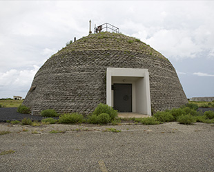
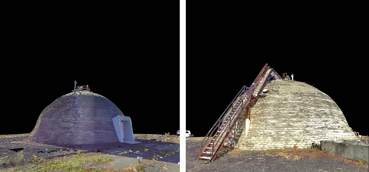
One of two "beehive" blockhouses at Complex 31/32 at the Cape Canaveral Air Force Station. Click on the image to see the virtual three-dimensional model of the blockhouse. (USAF/Eddie Green) |
"This presents an alternative to a physical tour," he said.
The next phase of the project, scheduled to begin in 2015, will include laser scanning and 3-D spatial technologies to identify, evaluate and document baseline conditions at the launch complexes. With baselines established, the project will evaluate condition changes and deterioration over five years of continued monitoring.
The resulting data will help the 45th Space Wing plan and prioritize future preservation and restoration efforts, stated Mowery.