|
Author
|
Topic: Apollo 14: Reaching Cone Crater by rover
|
Paul78zephyr
Member Posts: 720
From: Hudson, MA
Registered: Jul 2005
|
 posted 05-04-2021 08:44 PM
  
If Apollo 14 had an lunar roving vehicle, could Alan Shepard and Edgar Mitchell have driven to the top of Cone Crater? |
oly
Member Posts: 1228
From: Perth, Western Australia
Registered: Apr 2015
|
posted 05-04-2021 10:55 PM

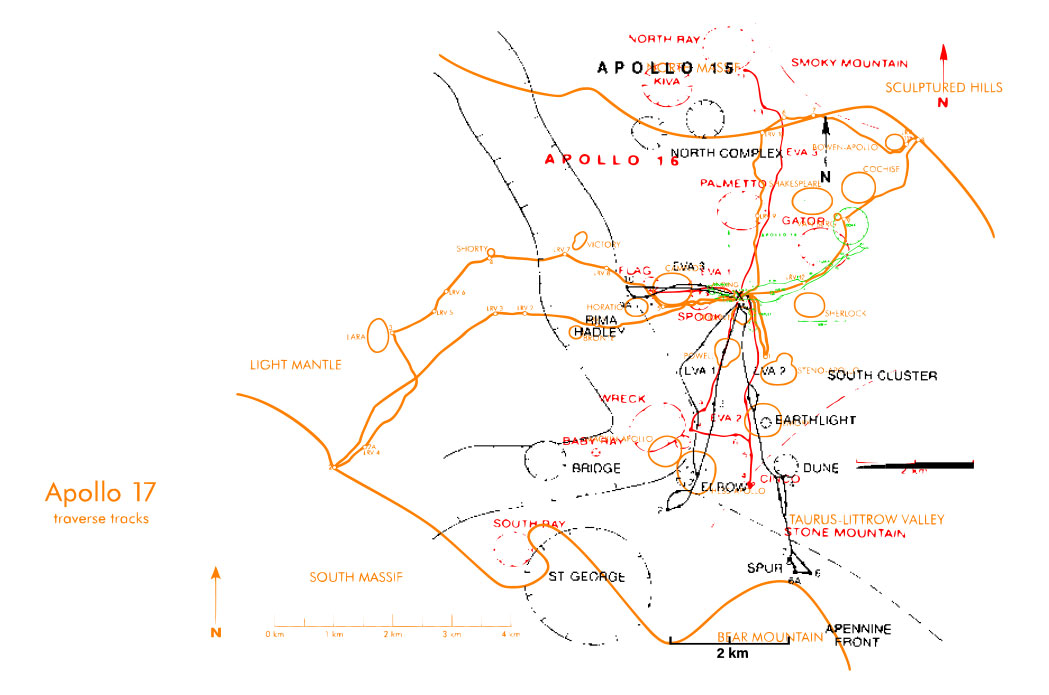
I have overlaid each lunar surface EVA traverse map to compare the distances traveled by each mission, aligned by landing site. The Apollo 11 map is included, but fits within the landing site marker of other missions. Apollo 14 is green.Theoretically, if the Apollo 14 mission had a lunar rover vehicle, it could easily traverse the distance that the Apollo 14 crew walked. The rovers demonstrated their ability to climb hills, and the allocated EVA mission time would allow for the rover to zig-zag the climb up Cone Crater.  |
Mike Dixon
Member Posts: 1551
From: Kew, Victoria, Australia
Registered: May 2003
|
posted 05-04-2021 11:45 PM
quote:
Originally posted by Paul78zephyr:
If Apollo 14 had an lunar roving vehicle, could Alan Shepard and Edgar Mitchell have driven to the top of Cone Crater?
With consummate ease. Maybe 1.3 or 1.4 km max from Antares. |
Headshot
Member Posts: 996
From: Vancouver, WA, USA
Registered: Feb 2012
|
posted 05-05-2021 03:44 PM
Actually Shepard and Mitchell did reach the top of Cone Crater. According to LRO images, they walked a mere 20 meters from the edge. Their C1 Station was on higher ground than the side of the rim opposite, so they actually looked over the crater pit itself. The problem was that they did not know exactly where they were. All they would have needed was a better navigation tool than their maps. |
Space Cadet Carl
Member Posts: 267
From: Lake Orion, MI
Registered: Feb 2006
|
posted 05-07-2021 07:40 AM
There was some really slick photographic detective work done after Shepard and Mitchell returned in 1971 to determine how close they actually came to the edge. Like Headshot said, the LRO confirmed those findings when it flew overhead a few years ago. |
One Big Monkey
Member Posts: 176
From: West Yorkshire, UK
Registered: Jul 2012
|
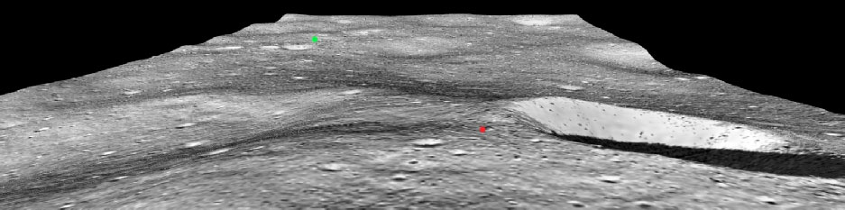
posted 05-07-2021 10:43 AM
I did some 3D modelling of the area and came up with this: The red dot is my estimate of where they got to, the green dot the LM. You can see that as cone crater was angled away from them they just wouldn't have seen it. |
Blackarrow
Member Posts: 3312
From: Belfast, United Kingdom
Registered: Feb 2002
|
posted 05-07-2021 04:18 PM
As one of the NASA geologists said to Shepard after the mission: "You weren't lost, but you didn't know it." |
Henry Heatherbank
Member Posts: 287
From: Adelaide, South Australia
Registered: Apr 2005
|
posted 05-08-2021 04:57 AM
quote:
Originally posted by One Big Monkey:
I did some 3D modelling of the area and came up with this...
That is an excellent representation of the issue Shepard and Mitchell faced in not being able to find the rim. It probably never occurred to them that they were on higher ground than the crater and were looking directly over it. |
Paul78zephyr
Member Posts: 720
From: Hudson, MA
Registered: Jul 2005
|
posted 06-07-2021 10:38 AM
If they had the LRV would its navigation system have ensured that they got to the edge of Cone crater? |
Kite
Member Posts: 951
From: Northampton UK
Registered: Nov 2009
|
posted 06-07-2021 01:43 PM
I have always thought that if Al Shepard had taken the normal route of being back up commander of Apollo 13 and then commander of prime crew Apollo 16, as the eldest man to land on the Moon he would have had the benefit of the Lunar Roving Vehicle (LRV) to get around. Pulling the Modular Equipment Transporter (MET) on Apollo 14 looked very hard work.However, he was in a privileged position to know that flights could be cancelled so didn't want to risk not getting one. |
oly
Member Posts: 1228
From: Perth, Western Australia
Registered: Apr 2015
|
posted 06-08-2021 07:40 AM
quote:
Originally posted by Paul78zephyr:
If they had the LRV would its navigation system have ensured that they got to the edge of Cone crater?
No. The Apollo lunar rover navigation system used a directional gyro unit and odometer pulses from four wheels to determine and display total distance traveled and vehicle speed, and to determine and display range and bearing to the LM referencing lunar north. The crew was required to align the directional gyro with lunar polar north before each deployment. Gyro drift, alignment accuracy, and wheel spin meant that the navigation system was not precise, it was predominantly used to provide the crew with a reference used to return to the lunar module.For each mission, the distance traveled, recorded by the odometer, and the distance traveled, as measured by map, differed (but within the designed 600-meter position error specification). The navigation system would have given the crew an idea that they were close, but because the traverse was uphill, and no accurate topographical data was available that could be used to calculate a precise surface distance from the LM to the target (you would need to know the precise rover starting position, distance to the target using the profile of the terrain, and travel in a straight line). Depending if the crew eye line was the same height when seated on the rover and standing, how easier or more difficult it would have been to identify the crater edge may also have changed. |